 Redmond Fire & Rescue Partners with Kiwanis Club of Redmond for Food Drive (Photo)
Redmond Fire & Rescue - 10/26/26 8:00 AM
October 26, 2026-Redmond, OR — Redmond Fire & Rescue is proud to announce its partnership with the Kiwanis Club of Redmond for this year’s Food Drive. This community initiative aims to provide essential food items to local families in need during the holiday season.
The food drive will run from October 30th through December 31st, with the collection point at Redmond Fire & Rescue's downtown station, located at 341 NW Dogwood Ave. Donations of non-perishable food items such as canned goods, pasta, rice, and boxed meals are encouraged.
“Our mission goes beyond emergency response—we’re committed to supporting the community in every way we can,” said Ryan Herrera, Fire Chief of Redmond Fire & Rescue. “Partnering with the Kiwanis Club of Redmond allows us to make a real difference for families during the holidays.”
The Kiwanis Club of Redmond has a long-standing tradition of serving the community, and this collaboration strengthens efforts to ensure no family goes hungry this Thanksgiving.
How to Help:
- Drop off non-perishable food items at Redmond Fire & Rescues downtown station.
- Share this initiative on social media to spread the word.
Oregon State Fire Marshal - 10/25/26 3:35 PM
SALEM, Ore. – The Oregon State Fire Marshal has mobilized several resources to help first responders, including a hazmat team, to a large fire at Pacific Seafood in Newport. The fire was first reported on Sunday morning. State Hazmat Team 05, Linn-Benton, responded because of the presence of anhydrous ammonia, used in refrigeration, at the facility. The team is using specialized equipment to monitor the air and is modeling where there may be impacts to help with evacuations.
The agency is mobilizing a task force with a ladder truck and four engines to provide relief to local firefighters. The task force from Marion County will arrive this evening to relieve crews battling the fire. A strike team from Lane County with five engines will arrive tomorrow morning.
“The ammonia tank has been found and, thankfully, doesn’t appear to be punctured or leaking. Our team is on the ground and will remain in Newport through the duration of the incident,” State Fire Marshal Mariana Ruiz-Temple said. “The Oregon Fire Mutual Aid System is frequently used during wildfire response; it is designed for all hazards, including hazmat. This response highlights its strength in protecting communities and providing resources to local responders.”
The Lincoln County Sheriff’s Office has issued levels 2 and 3 evacuations for those within a mile of the facility. The sheriff’s office provides all evacuation information. A map of evacuations can be found on their website. People are asked to avoid the area.
The Oregon State Fire Marshal has a regional mobilization coordinator on scene who is working closely with Newport Fire to provide any additional support.
ABOUT THE OREGON STATE FIRE MARSHAL’S HAZMAT PROGRAM
The Oregon State Fire Marshal manages the state hazmat response program. The Regional Hazardous Emergency Response Teams are among the most highly trained first responders in the country, completing a rigorous 160 hours of initial training before joining a team. They are a resource for local fire agencies when an incident exceeds their capacity. Outside of a response, they can provide technical guidance. Oregon has 12 teams across the state.
[email protected]
U.S. Attorney's Office - District of Oregon - 10/23/26 5:47 PM
U.S. Attorney, Federal Law Enforcement to Announce Results of
Coordinated Enforcement Operation
PORTLAND, Ore.— Scott E. Bradford, U.S. Attorney for the District of Oregon, will hold a press conference on Monday, October 26, 2026, alongside multiple law enforcement partners—including the Bureau of Alcohol, Tobacco, Firearms and Explosives (ATF), the Drug Enforcement Administration (DEA), the Portland Police Bureau, and the Gresham Police Department—to announce the results of a coordinated federal law enforcement operation.
|
Date |
Monday, October 26, 2026 |
|
Time |
Camera preset at 2:15 p.m. Press conference to begin at approximately 2:30 p.m. |
|
Speakers |
U.S. Attorney Scott Bradford |
|
Location |
U.S. Attorney’s Office, District of Oregon |
|
Access |
All credentialed media are invited to attend. |
|
Photo/Video |
Credentialed media are welcome to use camera and audio equipment during the press conference. Livestreaming is permitted, but public Wi‑Fi is not available. Use of camera and audio equipment is prohibited throughout the courthouse except within the designated press conference area. |
|
RVSP |
Please RSVP to [email protected]">[email protected] to confirm attendance.
|
VanNatta Public Relations - 10/23/26 4:44 PM
PORTLAND (Oct. 23, 2026) – PRSA Oregon — a local chapter of the premier professional organization for public relations professionals from Oregon and southwest Washington — announced the 2026 Spotlight Awards of Distinction winners. These awards recognize individuals who have given exemplary service to the chapter, profession and community. These honors will be awarded at the Spotlight Awards, on Nov. 18, 2026, at Nordic Northwest, Nordia House.
“These recognitions are a small token of our collective appreciation for these public relations leaders,” said Kelliann Amico, APR, Fellow PRSA, president of PRSA Oregon.
William W. Marsh Lifetime Achievement Award
Carol Fenstermacher, APR, Fenstermacher PR, Camas, WA
William W. Marsh Lifetime Achievement Award honors an outstanding leader and PRSA Oregon Chapter member who has performed significantly in one or more of the following areas: developing public relations as a credible profession, accomplishing landmark professional achievements and furthering the goals of PRSA.
Ron Schmidt Community Involvement Award
Darcie Meihoff, APR, PR Consultant and Board President Oregon Wild, Portland
Ron Schmidt Community Involvement Award honors the outstanding use of public relations to support community improvement and important causes.
Olga M. Haley Mentorship Award
Brad Hilliard, APR, Sisters of St. Mary of Oregon, Beaverton
Olga M. Haley Mentorship Award reflects the chapter’s dedication to supporting members at every stage of their careers and lives.
New Professional Award of Excellence
Ryan VanNatta Gail, MBA, CAE, VanNatta Public Relations, Salem
The New Professional Award of Excellence is presented to a professional who has entered the field of public relations within the past five years and demonstrated their commitment to advancing public relations through career achievements, volunteerism and the highest standards of professionalism.
To read more about each honoree’s accomplishments, click the link in their name or visit the blog.
To learn more about the Spotlight Awards and purchase tickets, visit the PRSA Oregon website.
###
About PRSA
PRSA is the leading professional organization serving the communications community through a network of more than 400 professional and student chapters in the U.S., Argentina, Colombia, Mexico, Peru and Puerto Rico. Guided by its Code of Ethics, PRSA empowers its members to succeed at every stage of their careers through a wide breadth of premium professional development programs, exclusive networking events and leadership opportunities. Signature events include the Anvil Awards and ICON, the premier annual gathering for communications professionals and students. For more information, visit www.prsa.org.
About PRSA Oregon
The Public Relations Society of America Oregon Chapter (PRSA Oregon Chapter) is the premiere communications, public relations and marketing chapter serving the state of Oregon, and Clark and Skamania counties in the southwest region of Washington state. To learn more about PRSA Oregon or to become a member, visit the website. Stay connected through LinkedIn and Instagram.
Attached Media Files: Carol Fenstermacher, APR , Brad Hilliard, APR , Darcie Meihoff, APR , Ryan Gail, CAE
U.S. Attorney's Office - District of Oregon - 10/23/26 3:48 PM
EUGENE, Ore.— Linh Luu and Kevin Le, a husband and wife from Anaheim, California, pleaded guilty today in federal court in Eugene, Oregon, to violating the Lacey Act. The court sentenced them to three years’ probation and a $10,000 fine each for their roles in trafficking wildlife between Oregon and Vietnam.
According to court documents and statements made in court, Luu and Le admitted that between September 2019 and May 2021, they processed $51,100 in payments to help an individual in Vietnam illegally move wildlife items to and from Oregon. The trafficked items included American black bear gallbladders and cougar bones, which were shipped to Vietnam; and lion teeth, segments of black rhinoceros and white rhinoceros horns, and a tiger pelt, all of which were imported into Oregon.
According to court documents, Luu and Le met an undercover federal agent in December 2020 in a parking lot. They accepted $12,000 in cash as a down payment for part of a rhino horn and discussed methods to avoid U.S. banking regulations designed to detect illicit transactions. They later each received nearly $5,000 in electronic payments for the horn segment, which was shipped to Oregon disguised as a household decoration. The sale was discussed as a way to build trust for future, larger deals.
“Wildlife trafficking threatens some of the world’s most vulnerable species and fuels criminal networks that profit from their destruction,” said Scott Bradford, U.S. Attorney for the District of Oregon. “This case demonstrates that our office will hold accountable not only the poachers, but also the financial facilitators who keep these markets alive. We are committed to working with our federal and state partners to disrupt these networks and protect endangered wildlife for future generations.”
“This investigation clearly illustrates that wildlife trafficking isn’t a victimless, white‑collar crime. It’s the financial engine behind the slaughter of species like rhinos, tigers, and black bears,” said Doug Ault, Assistant Director, Office of Law Enforcement, U.S. Fish and Wildlife Service. “Every dollar laundered through wildlife trafficking networks represents real damage that cannot be undone. Poachers take the wildlife, but organizers and financial facilitators make the killing profitable, and the Service and our law enforcement partners will continue pursuing everyone who builds and bankrolls these networks.”
All of the wildlife involved in this case is protected under the Convention on International Trade in Endangered Species of Wild Fauna and Flora (CITES), a treaty signed by the United States, Vietnam, and 183 other governments to regulate commercial trade in species that are or may become extinct. Trade in listed species is prohibited without a permit, which the defendants did not obtain. Black bears and cougars are native to Oregon and are prized by some for use in traditional Asian medicine. Lions, tigers, and black and white rhinoceroses are also protected under the Endangered Species Act. The Lacey Act, the nation’s oldest wildlife trafficking statute, prohibits, among other things, buying or selling wildlife that was illegally imported or exported.
The U.S. Fish and Wildlife Service’s Office of Law Enforcement investigated the case with assistance from Homeland Security Investigations and the Oregon State Police. The case was prosecuted by Assistant U.S. Attorney William McLaren and Senior Trial Attorney Ryan Connors of the Environmental Crimes Section of the Justice Department’s Environment and Natural Resources Division, with support from Assistant U.S. Attorney Adam Nate.
###
Attached Media Files: Release_CaliforniaCoupleSentencedforTraffickingLionTeethTigerPeltandRhinoHorn102326.pdf , Photo of tiger pelt trafficked by defendants, from sentencing memo in case number 26-cr-00297 in U.S. District Court for the District of Oregon. , Lion teeth trafficked by the defendants to Oregon, from sentencing memo in case number 26-cr-00297 in U.S. District Court for the District of Oregon. , Photo of a part of a rhino horn (left) and the same rhino horn part disguised as a house good to thwart customs (right), from sentencing memo in case number 26-cr-00297 in U.S. District Court for the District of Oregon. , Photo of a part of a rhino horn (left) and the same rhino horn part disguised as a house good to thwart customs (right), from sentencing memo in case number 26-cr-00297 in U.S. District Court for the District of Oregon.
Oregon Employment Department - 10/23/26 1:41 PM


For immediate release: October 23, 2026
Media Contact: [email protected]
Oregon Employment Department celebrates National Disability Employment Awareness Month
Salem, Ore. — The Oregon Employment Department (OED) is celebrating National Disability Employment Awareness Month (NDEAM) this October by highlighting how people with disabilities contribute to Oregon’s workforce and how employers can draw from this talented pool of individuals.
This year’s theme, “Celebrating Value and Talent,” recognizes the skills and contributions people with disabilities bring to workplaces, communities, and the economy.
WorkSource Oregon — a statewide partnership that includes OED’s Workforce Operations division — provides services to help job seekers with disabilities find jobs that match their skills and interests. WorkSource Oregon can also support employers in matching skilled people with disabilities with their specific job openings.
Job seekers, including those with disabilities, can meet one-on-one with staff to identify employment goals and develop a plan for their job search. Staff can help with resumes, applications, and interviews and connect job seekers with employers and job opportunities. Customers can also explore career options, training, and other resources that can help them prepare for and succeed in a new job.
“Oregon’s workforce is stronger when people have opportunities to use their skills, build careers, and contribute to their communities,” said OED Director Andrew R. Stolfi. “We’re honored to help job seekers with disabilities connect with opportunities to thrive in the workplace, and with partner agencies for added support.”
WorkSource Oregon partners include the Oregon Department of Human Services’ Vocational Rehabilitation program, the Oregon Commission for the Blind, and other workforce partners that provide individuals with disabilities with specialized employment services and supports. Vocational Rehabilitation helps remove possible barriers to employment, and the Oregon Commission for the Blind provides job search assistance, skills training, and workplace support for eligible Oregonians who are blind.
These WSO partnerships help job seekers identify career goals, build skills, and connect with employment opportunities. They also allow customers to access different types of support through Oregon’s broader workforce system as they move toward employment.
WorkSource Oregon also works with businesses that want to recruit and retain workers with disabilities. Staff can help employers reach potential candidates and connect with workforce resources. These partnerships can help businesses expand their talent pool while creating more opportunities for job seekers.
“Every job seeker brings different skills, experiences, and goals to their job search,” said Workforce Operations Director Jim Pfarrer. “We help job seekers with disabilities explore career opportunities, prepare for employment and connect with employers. We also work with our partners to make sure people can access the services and support they need to succeed.”
WorkSource Oregon staff can help employers who want to use National Disability Employment Awareness Month as an opportunity to explore how they can improve their recruitment, hiring and retention practices to expand opportunities for workers with disabilities. Disability can be apparent or non-apparent, and every worker brings different strengths, experiences, and perspectives to the workplace.
Job seekers and businesses can learn more about free WorkSource Oregon services and find their nearest WorkSource Oregon center at WorkSourceOregon.org.
People who need an accommodation or help accessing WorkSource Oregon services can also contact their local WorkSource Oregon center for help.
About Workforce Operations and WorkSource Oregon
The Oregon Employment Department’s Workforce Operations division is a partner in WorkSource Oregon, a consortium of state agencies and local workforce boards, and operates 37 WorkSource Oregon centers across the state. WorkSource Oregon offers a wide range of free services to job seekers, employers, and businesses, including personalized career coaching, resume writing, job search strategies, support for job postings and hiring incentives, and access to labor-market data. Visit worksourceoregon.org for more information.
Need help?
WorkSource Oregon (WSO) is an equal opportunity agency. WSO provides free help so you can use our services. Some examples are sign language and spoken-language interpreters, written materials in other languages, large print, audio, and other formats. To get help, please call 503-947-1680. TTY users call 711. You can also send an email to [email protected]">[email protected].
WorkSource Oregon (WSO) es una agencia de igualdad de oportunidades. WSO proporciona ayuda gratuita para que usted pueda utilizar nuestros servicios. Algunos ejemplos son intérpretes de lengua de señas e idiomas hablados, materiales escritos en otros idiomas, letra grande, audio y otros formatos. Para obtener ayuda, por favor llame al 503-947-1680. Usuarios de TTY pueden llamar al 711. También puede enviar un correo electrónico a [email protected]">[email protected].
###
Oregon Dept. of Human Services - 10/23/26 11:42 AM
(Salem, Ore.) ― The Oregon Department of Human Services Office of Developmental Disabilities Services (ODDS) seeks public comment on the following Medicaid waivers:
- 1915 (c) Children’s Extraordinary Needs (CEN) Waiver
- 1915 (b) (4) Fee-for-Service Selective Contracting Program
Summary of substantial updates
Increase the number of children served in the CEN waiver
Originally, the 1915 (c) CEN Waiver could serve 155 children at one time. We’re increasing the number of children that can be in the CEN program to 230 children at a time. This helps us plan for children entering and leaving the program during the year. We’re also increasing the total number of children who can be in the CEN program during a one-year period from 171 to 280. We’re asking the Centers for Medicare and Medicaid Services (CMS) to approve this change retroactively to July 1, 2026.
Context for the proposed change: The CEN program started July 1, 2024. The Oregon Legislature gave the program a limited budget. At that time, we estimated that the program’s budget could support 155 children at a time. About 15 months after the program began, we had enough data to begin analyzing the program’s service usage. The average cost per child was lower than expected. Since then, the data continues to affirm this finding. That’s why we can expand the program to serve more children within its budget. The federal government doesn’t consider this a big change, so we can ask for a retroactive start date to July 1, 2026, which is when we expanded enrollment for the program.
Updated cost projections for CEN case management services
The 1915 (b) (4) Fee-for-Service Selective Contracting Program allows ODDS to specify the number and type of case management entities that are allowed to provide waiver case management services. Cost projections for CEN case management are included in this waiver. We are updating these projections to account for the increase in the number of children served in the CEN waiver. ODDS is asking CMS for a retroactive approval date of July 1, 2026.
How to submit feedback on the proposed changes
- Send an email to [email protected]">[email protected].
- Send written comments to ODDS Medicaid waiver/State Plan analyst, 500 Summer Street NE E-09, Salem, OR 97301.
The deadline for comments is Nov. 25, 2026. We must receive comments by this date.
More information
Read the drafted waivers and the community notice announcing these updates on the ODHS website.
Print versions of the updates are posted in local community developmental disabilities programs and support services brokerages.
To ask for a printed version, contact ODDS Medicaid Waiver/State Plan Analyst at 503-507-2083 or [email protected]">[email protected].
You can get this document for free in other languages, large print, braille or a format you need. Email [email protected]">[email protected] or call 503-945-5811. We accept all relay calls.
Attached Media Files: odds-2026-10-23-media-release-cen-waiver-en.pdf , odds-2026-10-23-media-release-cen-waiver-es.pdf
Bureau of Land Management Ore. & Wash. - 10/23/26 11:08 AM
When: Sunday, October 24, 7 a.m. to 4 p.m. PT
Where: BLM Bat Week webpage
Who: Ryan GosWING, an Oregon pallid bat
MEDFORD, Ore. – It's bat-ck! The Bureau of Land Management is hosting its annual Bat Beauty Contest with a brand new group of stunning contestants.
On Sunday, Oct. 24, Oregon’s own Ryan GosWING will go head-to-head with Dolly BATton, Miss Montana, in the first round. Visit the BLM’s webpage to learn more about Bat Week and vote for Ryan GosWING.
If he makes it through the first round, he’ll represent the Pacific Northwest in the Final Four on Wednesday, Oct. 28. Oregon bats have taken home the crown in the last three contests! Most recently, Hoary Potter was named the winner.
Help us take home a four-peat by voting for this year's Oregon bat when the contest begins on Oct. 24. Make sure you're following Bureau of Land Management so you don't miss your chance to vote!
See the attached media advisory from the BLM for more details.
-BLM-
The BLM manages about 245 million acres of public land located primarily in 12 western states, including Alaska, on behalf of the American people. The BLM also administers 700 million acres of sub-surface mineral estate throughout the nation. Our mission is to sustain the health, diversity, and productivity of America’s public lands for the use and enjoyment of present and future generations.
Central Oregon Drug Enforcement (CODE) - 10/22/26 4:39 PM
Date: Oct. 22, 2026
Case #: Prineville Police Case # 2026-001228
Incident: Law enforcement seizes 69 guns during search warrant execution
Date / Time of Incident: Oct. 21, 2026 / 6 p.m.
Location: 60000 block of Winnebago Lane, Bend
Suspect: Eric Keith Testerman, 66-year-old Bend resident
Offenses: Manufacture, Importation, Sale or Transfer of Undetectable Firearms; Unlawful Possession of Machine Guns, Certain Short-Barreled Firearms and Firearms Silencers
In October 2026, detectives with Central Oregon Drug Enforcement (CODE) began investigating a report of a person manufacturing and selling ghost guns. Detectives identified the suspect as 66-year-old Bend resident Eric Keith Testerman.
At approximately 6 p.m. on Thursday, Oct. 21, CODE and the Central Oregon Emergency Response Team (CERT) executed a search warrant at a home in the 60000 block of Winnebago Lane in Bend.
During that search warrant execution, law enforcement seized 69 firearms, the majority of which did not have a serial number. Officers also seized manufacturing tools used to craft unserialized firearms found onsite. Many of the unserialized firearms were also short-barrel rifles and automatic firearms.
Firearms without serial numbers are commonly known as ghost guns. They are often self-assembled or 3-D-printed, and as a result the owner can bypass background checks and make it difficult for law enforcement to investigate the guns when they’re used in a crime.
Oregon House Bill 2005 prohibits the sale, transfer, or manufacture of untraceable, unserialized and 3-D printed firearms or unfinished frames and receivers for firearms made after October 22, 1968.
Testerman is not currently in the area, and was not present when the search warrant was executed. This investigation will be presented to a Deschutes County grand jury for consideration of the above-listed charges.
“This case highlights the importance of the CODE team in keeping our community safe through proactive and relentless investigation,” said CODE Team Deputy District Attorney Andrew Doyle.
CODE would like to thank CERT, Drug Enforcement Administration, Homeland Security Investigations, Bend Police, Redmond Police, Prineville Police and the Deschutes County Sheriff’s Office for their assistance in this investigation.
The Central Oregon Drug Enforcement (CODE) team is a multi-jurisdictional narcotics task force supported by the Oregon-Idaho High-Intensity Drug Trafficking Area (HIDTA) program and the following Central Oregon law enforcement agencies: Bend Police Department, Deschutes County Sheriff’s Office, Redmond Police Department, Prineville Police Department, Crook County Sheriff’s Office, Jefferson County Sheriff’s Office, Madras Police Department, Oregon State Police, Sunriver Police Department, Black Butte Police Department, United States Drug Enforcement Administration (DEA), Federal Bureau of Investigation (FBI), Deschutes, Crook, and Jefferson County District Attorney’s, and the Oregon National Guard.
The Oregon-Idaho HIDTA program is an Office of National Drug Control Policy (ONDCP) sponsored counterdrug grant program that coordinates and provides funding resources to multi-agency drug enforcement task forces to disrupt or dismantle local, multi-state and international drug trafficking organizations.
Central Oregon Drug Enforcement (CODE) Team
541-388-6643
Oregon Dept. of Forestry - 10/22/26 4:14 PM
SALEM, Ore. — The Regional Forest Practice Committee for northwest Oregon will meet at 11:30 a.m. on Thursday, Oct. 29 in the Santiam Room, Building D, ODF Headquarters, 2600 State Street, Salem. To join virtually, please use the Teams video conference information found on the agenda. To provide public comment, please email [email protected]">[email protected].
The committee’s agenda includes:
- Division and field updates
- Operator of the Year
- Workplan development
- Technical guidance development
- Compliance monitoring update
- Forest Practices Act training update
The public may attend in-person or online via Teams. Public comments will be accepted. Accommodations for people with disabilities, and special materials, services, or assistance can be arranged by calling at least 48 hours in advance of the meeting at 503-945-7200 or by email at [email protected]">[email protected].
Regional Forest Practices Committees are panels of citizens – mandated under Oregon law – that advise the Oregon Board of Forestry and may assist the Board of Forestry in developing appropriate forest practice rules. The committees are comprised of citizens qualified by education or experience in natural resource management. In 1971, the legislature enacted Oregon’s Forest Practices Act which includes three Regional Forest Practices Committees, serving the Eastern, Northwest, and Southwest regions of the state. Under Oregon law, a majority of the committees’ members must be private forest landowners and logging or forest operations companies.
Oregon’s forests are among the state’s most valued resources, providing a balanced mix of environmental, economic, and social benefits. View more information on the RFPC webpage.
Oregon State Marine Board - 10/22/26 3:52 PM
The Oregon State Marine Board will hold its quarterly board meeting beginning at 8:30 am on October 29 at the Bandon Public Library in the Sprague Room, located at 1204 11th St. SW. On October 28, the Board will hold a Work Session at 1 pm at the Bandon Community Center, 1200 11th St. SW. The Marine Board will discuss advancing boating technology during the work session.
Local recreational boaters are encouraged to attend the Work Session on the 28th and the Board meeting on the 29th; however, public comment will only be accepted at the beginning of the Board meeting and not the work session.
The following items are on the agenda:
- Director’s Report
- Free Waterway Access Days; informational
- NGO Outreach Programs and Grant Funding Update; informational
- Mini-Jet Boat Update; informational
- Wind Sport Regulations; informational
- Life Jacket Rulemaking; Board Vote
- Snake River Reciprocity for Outfitter Guides Rulemaking; Board vote
Public comments will be accepted in writing or during the meeting’s public comment period before the agenda items. To provide oral testimony, register by 5 p.m. on October 27, with Jennifer Cooper at [email protected]">[email protected] or by mail: Oregon State Marine Board, Attn: Jennifer Cooper, 435 Commercial St. NE, Suite 400, Salem, OR 97301.
Meeting materials and live stream link are available on the agency’s Public Meetings page.
Marine Board meetings use the Microsoft Teams application, and viewing may require installing the free Teams app.
Visit Boat.Oregon.gov to learn more about the Marine Board, Oregon’s recreational boating agency.
-End-
Public Information Officer
Oregon State Marine Board
971-707-2396
[email protected]
Oregon Health Authority - 10/22/26 3:06 PM
October 22, 2026
Media contact: Jonathan Modie, [email protected]
As climate hazards increase, Oregon communities fight back
OHA’s annual Climate and Health report shows extreme heat, wildfire smoke, drought are continuing burdens, but local projects are building resilience
PORTLAND, Ore.—Climate hazards are happening with more frequency in Oregon, with more days of extreme heat and wildfire smoke—and, in many areas, combinations of both—than 20 years ago, a new Oregon Health Authority (OHA) report shows.
But communities are fighting back with projects to mitigate the effects on human health, according to the OHA Public Health Division’s Climate and Health in Oregon report for 2025. These efforts are building resilience against worsening climate-related threats that can cause serious illnesses and death.
For example, Marion County is working with local partners to lower energy costs for older adults through home energy assessments and connect residents with contractors to install heat pumps and home weatherization. Jackson and Josephine counties and partners hosted a health fair in 2025 so more than 800 residents could learn about wildfire smoke risks and preparedness strategies.
“This year’s Climate and Health in Oregon report demonstrates that extreme climate effects continue to be a reality of our daily lives in Oregon,” said Public Health Division Director Naomi Adeline-Biggs. “We must continue supporting communities as they identify new, innovative, equitable approaches to adapting to these hazards and limiting health risks.”
Stark findings
Among the report’s starkest findings: between 2006 and 2025, the estimated number of days with extreme heat nearly doubled; wildfire smoke days tripled; and days with heat and smoke more than quadrupled. Rural counties in eastern, central and southern Oregon were hit hardest, racking up the highest number of extreme heat days, and rural southern and central counties with the highest total days with smoke.
However, wildfire smoke days increased fastest in Oregon’s biggest population centers. Even though Multnomah and Washington counties experience less smoke than other areas, the amount of wildfire‑related particulate matter in the air is now rising on average more quickly in these heavily populated areas than in other parts of the state.
In addition, the state experienced multiple drought periods, with widespread drought in 2015. In 2021, extreme drought affected half the state.
Damaging effects
The effects across Oregon have been damaging, the report shows.
From 2016 to 2025, hospital emergency departments saw spikes in visits for heat-related illnesses and smoke-related, non-infectious respiratory illnesses. Southern, central and eastern Oregon experienced some of the highest annual heat-related illness visit rates from 2016 to 2025. Although regions in western Oregon experienced lower annual heat related illness rates overall, all regions experienced increases during periods of extreme heat.
The report highlights impacts that extend beyond extreme heat and wildfires:
- Youth mental health: In 2025, results from the 2024 Oregon Student Health Survey showed 71% of Oregon 11th-graders reported experiencing stress about the future due to climate change, and 37% said these feelings negatively affected their lives.
- Harmful algae blooms: In 2025, OHA investigated 51 suspected harmful algae bloom events, issued 20 freshwater recreational use health advisories, and detected microcystin and saxitoxin levels that exceeded recreational use values.
- Mosquito-borne disease risk: In 2024 and 2025, routine mosquito surveillance identified Aedes aegypti in Jackson County, a mosquito species predominantly found in tropical and subtropical areas and the primary vector for diseases like dengue and Zika. This species of mosquito had not previously been detected in Oregon.
Communities are adapting
Like Marion, Jackson, and Josephine counties, agencies and organizations are finding new ways to help their communities adapt to climate change.
The Center for African Health and Education, a Portland-based, East African-led organization, used an OHA Public Health Equity grant to hold monthly workshops for the African refugee and immigrant communities on heat, air quality and wildfire smoke safety. It also created a messaging group so people could stay connected and get climate and health-related updates.
Latino Network, an organization focused on culturally specific practices and services, used a Public Health Equity grant to host its annual Conoce tu río, conoce tu comida: Know your river, know your food workshop. Participants exchanged cultural stories, learned about environmental health risks, and discussed ways to protect water and fishing tradition.
Carolina Hernandez, workforce development manager in Latino Network’s Department of Health and Wellness, said culturally specific climate adaptation is critical. “People share the stories of when they were in their counties of origin and how they went to the rivers, how they cook, how they spent days with the entire family sharing their lives and fishing ... We try to give space to the communities so they can do the same here.”
Another climate adaptation project involved OHA’s Youth Advisory Council, a group of 15- to 19-year-olds from across Oregon who provide input on health policies and initiatives related to well-being. Members of the council’s youth data subcommittee analyzed results from the 2024 Student Health Survey to find out how climate change is affecting youth.
Among the findings: stress arises from youth feeling climate change is out of their control and teaching lacks actionable steps or youth-led examples; Latinx, Middle Eastern, North African and Asian youth and those who identify as gender diverse or non-binary reported disproportionate mental health impacts of climate change; and students need mental health support from school counselors and other trusted adults who are knowledgeable about climate change.
“Students were saying the more you understand climate change, the more anxious or stressed you might feel,” said Andres Pineda, who attends Portland State University. “The issue is that students felt like there're not enough resources or different programs available to actually make a difference with climate change, to actually do something about it.”
Olivia Sun, a student at Jesuit High School in Beaverton, said the analysis shows youth are eager to help address climate hazards. “Just an opportunity for youth to be able to learn about it, an opportunity for youth to be able to feel like they're part of the solution,” she said, “would be great in resolving some of the anxiety and helplessness youth feel about climate change.”
Oregon and its partners are taking additional steps to adapt to climate threats. Investments in modernizing the state’s public health system help OHA, the Nine Federally Recognized Tribes of Oregon, local public health authorities and community-based organizations implement programs and policies focused on preparing and responding to more frequent and severe hazards.
Healthy Homes Grant Program funding helped local organizations make home upgrades that reduce health and safety risks, improve indoor conditions and create healthier living environments for low-income individuals and historically underserved communities.
For more information, visit www.healthoregon.org/climate.
Oregon Health Authority - 10/22/26 2:37 PM
October 22, 2026
Media contact: Jonathan Modie, [email protected]
OHA publishes final report on health risks from Crook County wells
PORTLAND, Ore.—Oregon Health Authority (OHA) has published its final report analyzing health risks related to drinking water from domestic wells near Prineville.
The Environmental Health Assessment Program in OHA’s Public Health Division today published its health consultation report following a two-month public comment period. The report found water in many of the nearly 60 domestic wells tested north of Prineville pose some level of health risk from contaminants—arsenic, nitrates and some coliform bacteria—common in Oregon wells.
In the report, OHA evaluated testing results for water samples and found about half of the wells had detectable levels of lead, which typically is from plumbing. About half also had manganese levels that can cause bad taste, discoloration, and cloudiness. Seven wells had manganese levels high enough to pose health risks to children under 1 year old, were they to drink it.
The report includes recommendations for households to mitigate risk and address well contamination, such as seeking blood lead testing, especially for children; treating their water; and verifying treatment effectiveness with additional testing.
OHA has shared well sampling results and health risk information with affected residents and offered one-on-one consultation with an OHA toxicologist.
The final report is unchanged from the public comment draft OHA released in June 2026, except for the inclusion in the appendix of five comments received during the comment period, along with OHA’s responses to the comments. All the comments were on topics outside the scope of OHA’s analysis and did not result in changes to the report.
OHA recognizes that access to safe drinking water is critical to the health of all people in Oregon. While the agency does not regulate the quality of private well water, it supports domestic well users by directing them to informational resources about well water testing, maintenance, and treatment, and health risks from contaminants.
The Crook County health consultation and supporting materials are on the OHA website at www.oregon.gov/crookcowells.
###
Oregon Department of Emergency Management (OEM) - 10/22/26 2:29 PM
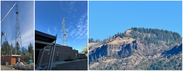
SALEM, Ore. — The Oregon Department of Emergency Management (OEM) wants to congratulate the Emergency Communications of Southern Oregon (ECSO 911)’s October 6 launch of the new countywide public safety radio system. ECSO 911 is the primary 911 center for Jackson County and Crater Lake National Park.
The new system strengthens radio communications between dispatchers and first responders across Jackson County and portions of Curry, Douglas, Klamath, Josephine, and Siskiyou (California) counties. The upgrade affects internal public safety radio communications and does not impact the ability of residents to call or text 911.
OEM’s statewide interoperability and preparedness teams partnered with ECSO 911, Jackson County and state and federal agencies to help support system planning and ensure compatibility with existing and future emergency communications infrastructure. The team supported technical coordination, grant alignment and statewide interoperability planning in coordination with the State Interoperability Executive Council, as the scope of the project grew to incorporate new technologies and improve redundancy.
“Interoperable, reliable communications save lives,” OEM’s Statewide Interoperability and Coordinator Jon Lee said. “Our interoperability and preparedness teams are proud to support this major upgrade, which strengthens Oregon’s emergency communications network and improves the safety of responders and the communities they serve.”
Project milestones include:
- A 2014 Department of Homeland Security grant awarded to Jackson County Fire District 3 to study public safety radio infrastructure.
- A 2016 conceptual design process that identified the P25 hybrid solution.
- Jackson County voters’ approval of a $28 million general obligation bond in 2019.
- A 2020 contract with Motorola Solutions and construction of 20 new or upgraded radio sites, including solar‑powered remote locations, completed in 2025.
- Deployment of about 1,700 to 1,800 radios to user agencies and extensive testing leading to the October 6 system cutover.
The project received additional support from the Oregon Legislature, the State Interoperability Executive Council, federal grant programs, the Oregon Department of Transportation, Oregon State Police and local public safety agencies.
OEM commends ECSO 911, Jackson County, partner agencies and local leaders for their collaboration and commitment to expanding and modernizing emergency communications in southern Oregon. Ongoing coordination among OEM, ECSO 911, fire and law enforcement agencies, and county service departments will help ensure a smooth transition and continued optimization of system performance.
The new system delivers real‑time, interoperable radio communications that enhance daily operations, mutual aid responses and multi‑agency coordination across both urban and remote areas.
It is the mission of the Oregon Department of Emergency Management (OEM) to lead collaborative, statewide efforts to support Oregon’s communities before, during and after emergencies, with a vision to create a ready and resilient Oregon. OEM prioritizes an equitable and inclusive culture of preparedness that empowers all Oregonians to thrive in times in crisis. For more information about OEM, visit oregon.gov/oem. You can get this document in other languages, large print, braille, or a format you prefer. For assistance, email [email protected]. We accept all relay calls, or you can dial 711.
U.S. Attorney's Office - District of Oregon - 10/22/26 2:07 PM
PORTLAND, Ore.— U.S. Attorney for the District of Oregon Scott Bradford announced today that Eder Fletes Calix, 24, of Beaverton, Oregon, was sentenced to two years and nine months in federal prison, to be followed by five years of supervised release, for possessing more than 700 grams of fentanyl with intent to distribute.
The sentence follows a multi-agency investigation that began in March 2025, when an Oregon State Trooper conducted a traffic stop on a vehicle driven by Fletes Calix. During the encounter, the trooper observed drug paraphernalia and cash in the vehicle. Both Fletes Calix and a co-defendant fled the scene on foot, prompting the execution of a search warrant that revealed more than 400 grams of compressed fentanyl powder inside the vehicle.
Over the following months, the U.S. Drug Enforcement Administration (DEA) continued the investigation and observed multiple drug transactions involving Fletes Calix and his co-defendant. Agents seized additional quantities of fentanyl from buyers during two separate stops in May and June 2025.
On July 2, 2025, federal agents arrested Fletes Calix and executed multiple search warrants, including at a Beaverton residence where he had been renting a room. Agents recovered approximately $22,000 in cash, drug packaging materials, digital scales, and additional quantities of fentanyl.
In total, investigators seized approximately 767.9 grams of fentanyl powder from the defendants’ vehicle, residence, and related transactions.
During a post-arrest interview, Fletes Calix admitted he knew the substance was fentanyl and acknowledged that he and his co-defendant were selling it.
Fletes Calix pleaded guilty to one count of possession with intent to distribute 400 grams or more of fentanyl, a Schedule II controlled substance. In determining the sentence, the Court considered the severity of the offense, the volume of fentanyl involved, and Fletes Calix’s lack of criminal history.
The case was investigated by the DEA and the Oregon State Police. It was prosecuted by Assistant U.S. Attorneys Jessica Keefer and Kate Rochat.
###
Oregon Dept. of Human Services - 10/22/26 1:40 PM
(Salem) — Medicare beneficiaries who would like to discuss plan options can receive free, confidential help from the Oregon Department of Human Services (ODHS) during Open Enrollment. Help includes comparing and selecting Medicare plans, reviewing their current coverage and assistance with making changes for the upcoming year.
Medicare Open Enrollment for 2027 plans began Oct. 15 and will remain open through Dec. 7, 2026.
The Senior Health Insurance Benefits Assistance (SHIBA) program provides free help from certified counselors who can help people understand their benefits and make informed decisions about their Medicare options.
During the Open Enrollment period, people with Medicare can:
- Switch from Original Medicare to a Medicare Advantage Plan,
- Switch from a Medicare Advantage Plan to Original Medicare,
- Change their Medicare Advantage Plan,
- Change or enroll in a Part D prescription drug plan, and
- Review changes in costs, coverage and provider networks.
SHIBA is one of several programs within the ODHS Office of Aging and People with Disabilities that provides services to older adults in Oregon regardless of their income. The information SHIBA provides not only supports older adults as they make decisions, but can help them recognize Medicare scams during Open Enrollment.
“Navigating Medicare coverage is complex and Oregonians should not have to navigate Medicare alone,” said APD Director Nakeshia Knight, Ph.D. “Our goal is to make that process easy, accessible, and free.”
Even if someone is happy with their current plan, a quick comparison can reveal better options. SHIBA certified counselors can help Oregonians compare plans and explain programs that can save them money on Medicare costs. Counselors can help beneficiaries avoid late-enrollment penalties and unexpected out-of-pocket charges, review annual plan changes, and ensure their prescriptions and preferred providers remain covered. Some Medicare beneficiaries may also qualify for cost-saving programs such as Medicare Savings Programs or Extra Help.
SHIBA reports scams to Medicare in addition to educating people on how to avoid Medicare scams or fraud. Common scams include claiming beneficiaries need a new card or offers of free medical equipment. These scams can happen by mail, over the phone, or by text and email. The best way to avoid Medicare scams is to keep Medicare numbers private; anyone who receives a message or email about Medicare from a number or person they do not recognize should not respond.
How to get free help
Help from SHIBA is available over the phone and through virtual and in-person appointments. To talk to a SHIBA certified counselor or to make an appointment, call SHIBA at 800-722-4134 (toll-free.)
Because high call volume during Open Enrollment may result in longer than usual wait times, Oregonians are also encouraged to access free resources on the SHIBA website at SHIBA.oregon.gov.
Online resources include:
- The 2027 Oregon Guide to Medicare Insurance Plans, which is available on the SHIBA website and will be translated to multiple languages in the coming weeks.
- Medicare frequently asked questions,
- An agent locator tool and
- A list of free virtual and in-person Medicare presentations
People who need Medicare help in a language other than English, including sign language, can call 833-685-0841 or send an email to [email protected]; after placing a request, a translator will reach out in the requestor’s preferred language to provide assistance in communicating with SHIBA.
About the Senior Health Insurance Benefits Assistance program
The Senior Health Insurance Benefits Assistance (SHIBA) program is part of the ODHS Office of Aging and People with Disabilities. It is a statewide network of certified counselors volunteering in their community to help all Oregonians make educated Medicare decisions. SHIBA offers free, objective, confidential and local one-on-one health insurance counseling and assistance to people with Medicare and their families.
This project is supported by the Administration for Community Living (ACL), U.S. Department of Health and Human Services (HHS) as part of a financial assistance award totaling $1,476,444 with 100 percent funding by ACL/HHS. The contents are those of the author(s) and do not necessarily represent the official views of, nor an endorsement, by ACL/HHS, or the U.S. Government.
Bend Fire & Rescue - 10/22/26 1:11 PM
At 12:51 a.m., Bend Fire & Rescue crews were called to reports of a structure fire at Black Bear Diner, located at the corner of Third Street and NE Olney Avenue in Bend.
Firefighters arrived to find flames reaching 15 to 20 feet above the roof. Crews extinguished the fire within minutes of arriving at the scene.
The fire was determined to have started when a faulty safety switch on the stove failed to shut off the gas as intended. The fire spread from the stove into the wall behind it and then into the attic. The diner sustained water and smoke damage throughout the restaurant. Damage to the structure and contents is estimated at approximately $250,000.
Firefighters credit the diner’s hood suppression system with minimizing damage to the structure. Bend Fire & Rescue inspectors inspected the system two weeks earlier, and the system activated successfully during the fire. A commercial kitchen hood suppression system is a specialized fire protection system designed to detect and extinguish grease, oil and open-flame fires within seconds. Businesses required to have hood suppression systems must have them inspected annually to ensure they are in working order.
Bend Fire & Rescue would like to thank the Bend Police Department for its support during the call. The fire was first reported by an on-duty Bend Police Department officer who noticed flames coming from the roof of the diner. Officers forced entry into the building and confirmed it was unoccupied before assisting incoming crews with traffic control around the scene.
[email protected], 541-385-6679
Makayla Oliver, Communications Manager, Bend Fire & Rescue
[email protected], 541-797-3584
Attached Media Files: Stovetop Ignition Area , Bend Fire Ladder Truck Crew Ventilating Diner Roof , Diner Kitchen and Attic Damage
Deschutes County Sheriff's Office - 10/22/26 11:10 AM
Deschutes County, Ore. – The Deschutes County Sheriff’s Office has seen an increase in the number of residents seeking to apply for a Concealed Handgun License (CHL) following last week’s tragic shooting at Silver Rail Elementary School. Since the incident, 204 individuals have signed up to begin the process of obtaining a CHL.
“Often after major incidents that impact our community, we see more interest in concealed handgun licenses,” said Deschutes County Sheriff Ty Rupert. “This trend is consistent with what we have observed historically, and we understand why many residents are thinking more about personal and family safety right now.”
In response to the heightened community interest, DCSO has scheduled an additional Concealed Handgun License training class on Saturday, November 14th. There are 45 spots available in the class, and nine citizens have already signed up. Additional classes will be made available based on demand.
CHL Training Information
- Saturday, November 14, 2026, 7am – 12pm
- Deschutes County Sheriff’s Office, 63333 Hwy 20, Bend, Oregon
- Cost: $150 (includes training and application fees)
- Sign up for the class using this link: CHL Saturday Class
As a reminder, Oregon law requires individuals seeking a CHL to complete an approved handgun safety course, submit an application through the Sheriff’s Office, pass a background check, and attend an in‑person appointment. Applicants must be at least 21 years old, reside in Deschutes County, be a U.S. citizen, and meet all eligibility requirements regarding criminal history and mental health prohibitions.
Sheriff Rupert emphasizes that firearm ownership carries significant responsibilities beyond the application process.
“Individuals have lawful rights related to firearm ownership, and those rights carry important responsibilities. Anyone considering purchasing a firearm, who has recently purchased one, or who is applying for a Concealed Handgun License should take time to make an informed decision, complete appropriate safety training, understand applicable laws, and plan for secure storage and responsible handling of any firearm,” explained Sheriff Rupert.
For more information on obtaining a CHL, visit the Sheriff’s Office website: Concealed Handgun License Info - Deschutes County Sheriff
###
Oregon Dept. of Forestry - 10/22/26 10:29 AM
SALEM, Ore. — The Compliance Monitoring Program Committee will hold a virtual meeting Thursday, Oct. 29, from 9 to 10:30 a.m. To join virtually, please use the Teams video conference information found on the agenda.
The committee’s agenda includes:
- Leadership and staffing updates
- CMP progress and future work
- Roads and steep slopes pilot study updates
The meeting is open to the public to attend online via Teams. Requests for an interpreter for the hearing impaired or other accommodations for persons with disabilities should be made at least 48 hours before the meeting by emailing [email protected]">Marta Frias-Bedolla.
The CMP Committee assists in efforts to monitor compliance with Forest Practices Rules. The committee advises ODF regarding monitoring projects and procedures. View more information on the CMPC webpage.
Oregon Dept. of Revenue - 10/22/26 8:55 AM
(Salem, OR)—Oregon and the Internal Revenue Service (IRS) are once again recruiting people to assist in the free preparation of taxes as part of the Volunteer Income Tax Assistance (VITA) or Tax Counseling for the Elderly (TCE) programs, and the Department of Revenue’s Taxpayer Advocate is encouraging Oregonians to volunteer.
“Too often those tax credits go unclaimed,” said Codi Trudell, Oregon’s Taxpayer Advocate. “The cost and complexity of filing a tax return is a hurdle for too many people.
“Oregon needs more VITA sites and volunteers. By volunteering to help them file their returns and claim their credits, Oregonians can make a difference for people in their local community.”
Volunteers don’t need to be tax experts. Training is provided by the IRS.
In addition to the need for volunteers, the IRS is also seeking organizations to sponsor VITA and TCE clinics.
Each tax season, the Oregon Taxpayer Advocate Office offers an interactive map of free tax assistance sites in Oregon on the Department of Revenue website. The VITA sites are represented as blue dots on the map.
“Each blue dot represents an organization that has volunteered to make tax assistance available to the people in their community who need it,” Trudell said. “More volunteers will mean more blue dots and more opportunities for Oregonians to get the tax preparation assistance they need.”
The VITA and TCE programs include training in a variety of roles, including providing free tax help for low-to-moderate income families who need assistance preparing their tax returns. Across the country, thousands of people volunteer each year and prepare millions of tax returns at thousands of tax sites nationwide.
Volunteers are assigned to work with a sponsoring organization, first to receive training and then to begin volunteering at a location in the community. Training is offered both online and in the classroom. Tax sites are generally open nights and weekends, and the hours are flexible.
Additional information is available on the IRS website. Interested persons can submit an inquiry now using the VITA/TCE Volunteer and Partner Sign Up form moving them one step closer to becoming a VITA or TCE tax volunteer and giving back to their community. The IRS will share information about those interested in volunteering with sponsoring organizations for follow-up contact.
Organizations with an interest in partnering with the IRS to sponsor or host a free tax preparation site in Oregon can also complete and submit the VITA/TCE Volunteer and Partner Sign Up form.
To find a local VITA site, taxpayers can use the IRS Site Locator tool or check the Oregon Department of Revenue’s Free Tax Help map with VITA sites marked in blue.
Bend Police Dept. - 10/21/26 4:47 PM
Date: Oct. 21, 2026
Case #: 2026-00058716
Incident: Bend Police arrest suspect with warrant after standoff
Date / Time of Incident: Oct. 21, 2026 / 11:24 a.m.
Location: 900 block of NE Francis Court, Bend
Arrested: Bryan Paul Hill, 46-year-old Bend resident
Offenses: Warrant, Burglary I, Unlawful Use of a Motor Vehicle, Restraining Order Violation x2
At approximately 11:24 a.m. on Wednesday, Oct. 21, Bend Police responded to a report from Deschutes County Parole & Probation officers that a man wanted on a warrant out of Idaho was inside a home in the 900 block of NE Francis Court.
Responding officers learned the suspect had a nationwide warrant out of Ada County (Idaho) for domestic battery. The suspect, identified as 46-year-old Bryan Paul Hill, was also wanted by Bend Police on suspicion of first-degree burglary, unlawful use of a motor vehicle, and two restraining order violations related to a September incident.
Officers surrounded the home and were able to get two other people out of the home, but Hill refused to exit for more than four hours, despite officers advising over a loud speaker that he was under arrest. The Central Oregon Emergency Response Team responded to the scene, and a large police presence was in the area.
After extensive negotiations, Hill agreed to leave the residence.
At approximately 3:49 p.m., he exited the residence and was taken into custody without incident. He was arrested and transported to the Deschutes County Jail on suspicion of the above offenses.
Oregon Health Authority - 10/21/26 3:44 PM
October 21, 2026
Media contact: Erica Heartquist, [email protected]
Recreational use advisory downgraded to a precaution for Cullaby Lake
Pet owners should continue to keep their pets away from areas that appear to have a bloom
PORTLAND, Ore. – Oregon Health Authority (OHA) has downgraded the recreational use health advisory to a precaution for Cullaby Lake.
OHA issued the advisory Sept. 17.
Water monitoring has confirmed that the level of cyanotoxins in Cullaby Lake are below recreational guideline values for people. However, levels detected are still above OHA’s educational guideline values for dogs, and owners should keep their pets away from areas with blooms.
OHA advises recreational visitors to continually be alert to signs of cyanobacteria blooms. This is because blooms can develop and disappear on any water body at any time when bloom conditions are favorable. Only a fraction of water bodies in Oregon are monitored for blooms and toxins, so it’s important for people to become familiar with the signs of a bloom, and exposure routes and symptoms by visiting OHA’s Cyanobacteria (Harmful Algae) Blooms website at http://www.healthoregon.org/hab.
When recreating, people, and especially small children, and pets should avoid areas where the water is foamy, scummy, thick like paint, pea-green or blue-green, or if thick brownish-red mats are visible or bright green clumps are suspended in the water. If you see these signs, avoid activities such as swimming or motorized or non-motorized boating activities that cause you to swallow water or inhale droplets, and keep pets out of the area.
Cyanotoxins can still exist in clear water. When a bloom dies, toxins released may reach into clear water around the bloom. Blooms can be pushed into other areas, leaving toxins behind. There also are species of cyanobacteria that anchor themselves at the bottom of a water body, live in the sediment, or can grow on aquatic plants and release toxins into clear water.
For health information or to report an illness, contact OHA at 971-673-0482, or visit OHA’s Cyanobacteria (Harmful Algae) Blooms website.
###
Ore. Dept. of Public Safety Standards and Training - 10/21/26 2:11 PM
DPSST LAW ENFORCEMENT OFFICER CERTIFICATION MAINTENANCE WORKGROUP MEETING SCHEDULED
Notice of Scheduled Meeting
The DPSST Law Enforcement Officer Certification Maintenance Workgroup will hold a meeting on Wednesday, October 28, 2026, at 2:00 p.m. in Conference Room A234 at the Department of Public Safety Standards and Training located at 4190 Aumsville Hwy SE, Salem, Oregon. For further information, please contact Jennifer Howald at [email protected] and (503) 551-3258.
The meeting will be recorded and posted on the DPSST YouTube page after the meeting: https://www.youtube.com/@DPSST
Agenda Items:
1. Introductions
2. Review and Discuss:
- Ethics Training
- Mental Health or Crisis Intervention Training
- Firearms or Use of Force Training
- Consideration of Additional Training Topics
- Leadership Training
3. Next Workgroup Meeting: Wednesday, December 9, 2026, at 2:00 p.m.
Administrative Announcement
This is a public meeting, subject to the public meeting law and it will be recorded. Deliberation of issues will only be conducted by Telecommunications Curriculum Advisory Committee members unless permitted by the Chair. Individuals who engage in disruptive behavior that impedes official business will be asked to stop being disruptive or leave the meeting. Additional measures may be taken to have disruptive individuals removed if their continued presence poses a safety risk to the other persons in the room or makes it impossible to continue the meeting.
DPSST provides reasonable accommodations to ensure equal access for people with disabilities and those with limited English proficiency. To request a sign language interpreter, translation services, or other accommodations, please contact Juan Lopez at (503) 551-3167 or at [email protected]">[email protected], at least 48 hours before the meeting.
DPSST proporciona acomodaciones rasonables para asegurar el acceso igual para personas con descapacidades y para personas con competencia limitada de inglés. Para pedir un interprete de lengua de señas, servicios de traducción, u otras acomodaciones, por favor de contactar a Juan Lopez marcando al (503) 551-3167, o a [email protected]">[email protected], al menos 48 horas antes de la reunión.
Department of Public Safety Standards and Training
Phone: 503-551-3167
E-Mail: [email protected]
U.S. Attorney's Office - District of Oregon - 10/21/26 2:03 PM
PORTLAND, Ore.— The U.S. Attorney’s Office for the District of Oregon today announced at least 40 people are facing federal charges for conspiring to defraud the United States of more than $3 million in fraudulent Supplemental Nutrition Assistance Program (SNAP) purchases. The schemes involved stealing EBT card data—often through skimming devices—to make unauthorized purchases of large quantities of SNAP‑eligible goods.
In a press conference this afternoon, U.S. Attorney Scott. E Bradford announced multiple new guilty pleas, 11 new indictments, and major federal sentences in two large interstate fraud schemes involving stolen Electronic Benefit Transfer (EBT) account information.
“When SNAP benefits are stolen, real families go without food,” said Scott E. Bradford, U.S. Attorney for the District of Oregon. “That is unacceptable. My office will continue pursuing these cases to safeguard the integrity of the program and uphold the trust placed in us to protect Oregon’s communities.”
“This organized criminal scheme not only resulted in the loss of food assistance benefits for needy families whose EBT card data was skimmed or otherwise stolen. Egregiously, the corrupt enterprise also placed public health and safety – including of babies – at risk by selling products like infant formula on the black market,” said USDA Inspector General John Walk. “I commend the U.S. Attorney’s Office, USDA OIG Special Agents, and our law enforcement partners for disrupting this dangerous scheme and bringing the fraudsters to face justice.”
Case Summaries
U.S. v. Ramirez Dumitru et al.
- In October 2024, a federal grand jury in Oregon charged 17 people in a scheme that stole more than $2.4 million in SNAP benefits.
- Investigators say that from August 2023 to October 2024, the group used skimmers and other methods to steal EBT card information, then used the stolen accounts to buy large amounts of infant formula, energy drinks, and other SNAP‑eligible items in Oregon, Washington, and California, including through curbside‑pickup orders.
- More than 120,000 pounds of goods were purchased with stolen benefits, stored in Oregon and Washington, and then shipped to California to be sold on the black market.
- All 17 defendants were arrested in October 2024.
- One defendant, Ana Escalante, who helped transport stolen goods across state lines, was sentenced in September 2026 to 27 months in prison and ordered to pay $2.4 million in restitution.
- So far, 12 defendants have been sentenced to a combined 157 months in prison, and two more have pleaded guilty and are awaiting sentencing in December 2026.
U.S. v. Alexandru Telescu et al.
- In November 2025, Alexandru Telescu and eleven others were charged in a 26‑count federal indictment involving a scheme to steal and use EBT card information.
- Estimated losses total $700,000.
- Starting in in April 2025, the group used stolen EBT numbers and PINs—and skimmers placed on retail payment terminals—to buy SNAP‑eligible items in Oregon, Washington, and California. They repeatedly made purchases with victims’ benefits, stored some of the items in storage units, and shipped others to California in vans and trucks.
- On September 29, 2026, Telescu pleaded guilty to access‑device fraud and aggravated identity theft and is scheduled for sentencing on January 28, 2027.
- Co‑defendants Aramis and Cristina Manolea previously pleaded guilty to conspiracy and were each sentenced in May 2026 to time served plus three years of supervised release.
New Indictments
U.S. v. Kehi
- On October 7, 2026, Bly Gnionsiekan Rodoophe Kehi was indicted by a federal grand jury for conspiracy to commit access‑device fraud and possession of device‑making equipment, alleging he installed skimming devices on Washington County payment terminals to steal customers’ card data.
Additional Cases
- In September and October 2026, federal grand juries charged ten additional defendants with unauthorized use of access devices and aggravated identity theft.
- Prosecutors allege that each defendant used stolen EBT card numbers and PINs during 2024.
- Each case involves more than $1,000 in merchandise obtained using benefits stolen from SNAP recipients. Estimated losses total $143,000.
Coordinated Law Enforcement Effort
A multi‑agency partnership—including USDA Office of Inspector General, IRS‑Criminal Investigation, Homeland Security Investigations, the U.S. Marshals Service, multiple police departments, and state agencies—is driving the investigation and prosecution of these cases. This coordinated effort targets organized groups responsible for stealing millions in SNAP benefits.
Continued Commitment to Enforcement
The U.S. Attorney’s Office remains committed to identifying, charging, and dismantling networks engaged in SNAP fraud and will continue working with partners across jurisdictions to protect recipients and safeguard taxpayer dollars.
###
Oregon State Police - 10/21/26 2:00 PM
MULTNOMAH COUNTY, Ore. (21 October 2026) - On Monday, October 19, 2026, at approximately 6:02 p.m., Oregon State Police responded to a two-vehicle fatal crash on Highway 30 near milepost 18 in Multnomah County.
The preliminary investigation indicated a green Subaru Outback, operated by Christopher Lee Matteson (48) of Columbia City, was traveling westbound on Highway 30 when, for unknown reasons, it crossed into the eastbound lanes and struck a red Volkswagen Bug, operated by Rachel Ann Mitchell (57), head-on.
The operator of the Volkswagen (Mitchell) was declared deceased at the scene.
The operator of the Subaru (Matteson) sustained serious injuries and was transported to an area hospital.
The highway was impacted for approximately six hours during the on-scene investigation.
OSP was assisted by the Scappoose Fire Department, Scappoose Police Department, and the Oregon Department of Transportation.
# # #
About the Oregon State Police Collision Reconstruction Unit (CRU)
The Oregon State Police Collision Reconstruction Unit (CRU) is a specialized unit responsible for investigating fatal and critical injury collisions on Oregon’s highways. The team provides expertise in documenting, investigating, and analyzing complex motor vehicle crashes and crime scenes. They receive specialized training in using advanced measuring techniques and small unmanned aircraft systems (sUAS) for on-scene investigations. The CRU team includes ACTAR-accredited collision reconstructionists and technical collision investigators deployed across the state.
Bend Police Dept. - 10/21/26 1:33 PM
Oct. 21 Silver Rail Elementary School Shooting Update
UPDATE: The Bend Police Department has confirmed that the firearm used in Thursday's shooting was purchased legally. We are not sharing further information about the firearm at this time.
The Bend Police Department continues its investigation into last Thursday's tragic incident at Silver Rail Elementary School.
This morning, dozens of officers were waiting at each of our Bend public schools to welcome students back to their classrooms. They'll be there again at the end of the day. You'll likely see an increase in police presence in and around our schools over the coming days and weeks. That's because we want students and staff to feel as comfortable as they can during a difficult, emotional time.
Our Department will continue working with the Bend-La Pine Schools as they assess safety protocols and operations in their schools.
Bend Police detectives continue this complex investigation. They have served search warrants at the shooting suspect's home, as well as on his electronic devices and his social media accounts on a variety of platforms. That work continues, and it takes time.
Our detectives continue to investigate details surrounding the firearm used in this incident.
There are still a lot of pieces to this case that we are unable to share at this time, and we appreciate your patience as we ensure the integrity of the investigation. It is important to our Department that we do this right.
Bureau of Land Management Ore. & Wash. - 10/21/26 9:49 AM
BAKER CITY, Ore. – The Bureau of Land Management is considering an operator’s plan to mine for gold across 820 acres of public land in Baker County. The BLM manages almost a third of the nation’s minerals, and gold mining is a critical piece of the administration’s effort to and build a more secure domestic supply chain.
“Gold has been an important part of Oregon’s mining history and economy,” said Mike Decker, acting Vale District Manager. “Oregon’s mineral resources are helping America build a more secure domestic supply chain.”
Over the next 20 years, the Reeds Gulch Mining Plan proses mining activity on about half of that land. Planned activities include exploration test pits, excavation pits and trenches, a processing site, and three settling and recycling ponds. Before mining is even complete, the operator would begin restoration work under the proposal. The operator would mine at individual sites, closing and reclaiming each site as mining work moves to the next area. Both mining and restoration work would occur concurrently throughout the proposed 20-year operation. The proposal does not include blasting for mining.
The BLM is accepting public comments on its environmental assessment of the Plan. The comment period closes Nov. 20, 2026. Project planning documents are available at the BLM National NEPA Register, where comments can be submitted through the “Participate Now” option (preferred). Comments may also be emailed to [email protected]">[email protected] or delivered to: BLM Baker Field Office, Attn. Reeds Gulch EA, 1550 Dewey Ave, Suite A, Baker City, OR 97814.
-BLM-
The BLM manages about 245 million acres of public land located primarily in 12 western states, including Alaska, on behalf of the American people. The BLM also administers 700 million acres of sub-surface mineral estate throughout the nation. Our mission is to sustain the health, diversity, and productivity of America’s public lands for the use and enjoyment of present and future genera
Oregon Parks and Recreation Dept. - 10/21/26 9:49 AM
Salem, Ore. — The Oregon Parks and Recreation Department’s All-Terrain Vehicle (ATV) Advisory Committee will meet Nov. 4 to review online and hands-on training stats, incident reporting, legislative updates and other ATV Program updates.
This will be a hybrid meeting with options to attend in person or via Zoom webinar – details below. The public can join as attendees. In the event that an in-person meeting is no longer feasible, the meeting will just be held on Zoom.
The ATV Advisory Committee meeting will begin at 9 a.m. The agenda and schedule are posted online.
Meeting details
Join in person
Best Western Mill Creek Inn
3125 Ryan Dr SE,
Salem, OR 97301
Join virtually via Zoom
Webinar ID: 844 9135 5047
Passcode: 120548
Join via audio only: 253-215-8782
Special accommodations may be arranged up to 72 hours in advance to improve accessibility by emailing [email protected].
The ATV Grant Program provides funding statewide for ATV recreation. Grant funds come from ATV user permit sales and a percentage of gasoline tax money. Read more about the state ATV program.
Oregon Dept. of Consumer & Business Services - 10/20/26 4:32 PM
Salem – Gov. Tina Kotek has officially proclaimed Oct. 19-23, 2026 as Community Bank Week in Oregon, recognizing the vital role community banks play in supporting families, small businesses, and communities across the state.
“For well over a century, community banks doing business in Oregon have provided local financial services and have supported the prosperity and growth of our communities,” said Gov. Kotek in the proclamation. “Community banks are an integral part of Oregon’s overall economy through their community giving, dedication as good neighbors, and above all, their critical role in providing reliable financial services to Oregonians.”
Community banks serve Oregon through:
- 113 branches and loan offices serving urban and rural communities
- Employing 2,365 Oregonians in family-wage jobs with competitive pay and benefits
- Over $1 billion in local small business lending that fuels entrepreneurship and job creation
- Significant charitable contributions each year
- Safeguarding over $9.2 billion in local deposits
“Community banks play a vital role in Oregon’s economy and in communities across the state,” said TK Keen, DFR administrator. “They provide essential financial services, support local businesses, and help strengthen the economic foundation of Oregon.”
Community banks are central to Oregon’s economic vitality, contributing to schools, infrastructure, and public services through taxes and serving the credit needs of all communities – including low- and moderate-income neighborhoods – under the federal Community Reinvestment Act. In many rural areas, they may be the only local financial institution, making this commitment especially important.
During Community Bank Week, banks across Oregon will celebrate with customer appreciation events, community service projects, food drives, free community shred events where residents can securely dispose of confidential documents, and other outreach efforts that highlight the positive impact of local banking. Discover more about community banks and connect with one in your area at www.oregonbankers.com/local.
###
About Oregon DFR: The Division of Financial Regulation protects consumers and regulates insurance, depository institutions, trust companies, securities, and consumer financial products and services. The division is part of the Department of Consumer and Business Services, Oregon’s largest consumer protection and business regulatory agency. Visit dfr.oregon.gov and dcbs.oregon.gov.
Deschutes County Sheriff's Office - 10/20/26 4:03 PM
To our community,
In the days since the Silver Rail Elementary tragedy, we have all been carrying grief that is difficult to put into words. Like so many of you, I have felt the heartbreak, the shock, and the deep sadness of knowing that lives were taken far too soon.
To the families who lost someone they love, there are no words that can ease the pain you are living with. Please know that you are in my thoughts and prayers, and that our entire community stands beside you. To the students, staff, first responders, and all those whose lives have been changed by this event, you are not alone.
May we never forget the loved ones we lost or the families who now carry unimaginable grief. May their memory inspire us to hold our loved ones closer, show kindness to those around us, and lift one another up in the days and years ahead.
Healing will not happen all at once. There is no right way to grieve, and no timeline for moving forward. I encourage each of us to check on one another, especially our children, educators, neighbors, first responders, and anyone who may be hurting quietly. Ask how they are doing, listen, offer support, because sometimes simply being present can mean more than we realize.
This tragedy has left a lasting ache in the heart of our community. Yet even in this sorrow, we have seen neighbors care for neighbors, strangers offer comfort, and people come together with extraordinary compassion. We will carry this grief together, hold one another close, and draw strength from one another in the difficult days and years ahead.
Sheriff Ty Rupert
Oregon State Police - 10/20/26 4:00 PM
MALHEUR COUNTY, Ore. (20 October 2026) - On Monday, October 19, 2026, at approximately 2:09 p.m., Oregon State Police responded to a two-vehicle fatal crash on Highway 26 near milepost 244 in Malheur County.
The preliminary investigation indicated a green Hyundai Santa Fe, operated by Autumn Jean Hansen (41) of Vale, was eastbound on Highway 26 when the vehicle turned into the path of a westbound white Ford Expedition, operated by Douglas Alan Sharp (62), of John Day.
The operator of the Hyundai (Hansen) was declared deceased at the scene. Hansen was not believed to have been wearing a seatbelt at the time of the crash.
The operator of the Ford (Sharp) sustained serious injuries and was transported to an area hospital.
Three juveniles in the Hyundai were flown to a regional hospital with serious injuries.
Witnesses reported the Hyundai may have been attempting a U-turn in front of the Ford, and it had also been observed making a U-turn prior to the crash.
The highway was impacted for approximately four hours during the on-scene investigation.
OSP was assisted by Vale Fire & Ambulance, Treasure Valley Paramedics, the Malheur County Sheriff’s Office, and the Oregon Department of Transportation.
# # #
About the Oregon State Police Collision Reconstruction Unit (CRU)
The Oregon State Police Collision Reconstruction Unit (CRU) is a specialized unit responsible for investigating fatal and critical injury collisions on Oregon’s highways. The team provides expertise in documenting, investigating, and analyzing complex motor vehicle crashes and crime scenes. They receive specialized training in using advanced measuring techniques and small unmanned aircraft systems (sUAS) for on-scene investigations. The CRU team includes ACTAR-accredited collision reconstructionists and technical collision investigators deployed across the state.
U.S. Attorney's Office - District of Oregon - 10/20/26 3:48 PM
MEDIA ADVISORY
U.S. Attorney to Announce Major Developments in SNAP Fraud Crackdown
PORTLAND, Ore.— Scott E. Bradford, U.S. Attorney for the District of Oregon, will hold a press conference on Wednesday, October 21, 2026, to announce major developments in the office’s ongoing efforts to combat large‑scale theft of Supplemental Nutrition Assistance Program (SNAP) benefits.
|
Date |
Wednesday, October 21, 2026 |
|
Time |
Camera preset at 12:45 p.m. Conference to begin at approximately 1:00 p.m. |
|
Location |
U.S. Attorney’s Office, District of Oregon |
|
Access |
All credentialed media are invited to attend. |
|
Photo/Video |
Credentialed media are invited to use camera and audio equipment during the press conference. Livestreaming is permitted, but public Wi-Fi is not available. Use of camera and audio equipment is prohibited throughout the courthouse, except within the designated press conference area. |
|
RVSP |
Please RSVP to [email protected]">[email protected] to confirm attendance.
|
Oregon Housing and Community Services - 10/20/26 2:18 PM
Recognition highlights strategies to preserve more than 2,200 affordable rental homes
SALEM, Ore. — Oregon Housing and Community Services (OHCS) received a national Award for Program Excellence from the National Council of State Housing Agencies (NCSHA) for its work to preserve affordable rental housing and strengthen housing stability across Oregon.
The award was presented Oct. 5 during NCSHA’s 2026 Annual Conference in Detroit. OHCS was recognized in the Rental Housing category, Encouraging New Construction and Promoting Preservation, for “Strategies to Preserve Oregon’s Affordable Housing Portfolio.”
The recognition highlights the agency’s coordinated approach with partners to protect existing affordable homes through targeted financial investments.
“Day by day, community by community, we are working to build an Oregon that everyone can afford to call home,” said OHCS Executive Director Andrea Bell. “OHCS is grateful to our partners for helping us deliver on this commitment to the people of Oregon.”
Across Oregon, affordable housing properties face rising operating costs, aging buildings, and financial pressures that can threaten long-term affordability. An OHCS analysis of 748 properties with more than 47,000 homes found operating costs increased 20% between 2021 and 2023, while rental income only grew about 11%. To address these challenges, OHCS launched Property Stabilization Investments in October 2025. The program awarded $39 million to 30 projects, helping preserve more than 2,200 affordable rental homes. The funding came from a legislative investment in housing preservation approved in 2025.
Working with property owners and lenders, the program helps financially distressed properties reduce debt and lower monthly loan payments. These investments improve properties’ ability to cover operating costs and maintain affordable housing. This limited funding also supports addressing needed critical repairs that can return vacant homes to active use.
OHCS paired these investments with approximately $2 million in capacity-building grants to 13 partners across the state to strengthen property and asset management. The agency also reduced administrative burdens by providing more flexibility in waitlist management, implementing Housing Opportunity Through Modernization Act requirements to streamline verification processes across programs and allow additional verification methods, and simplifying income recertification requirements where permitted. These changes help housing providers focus resources on residents and property operations, and not red tape.
Together, these strategies help protect public investments in affordable housing and support long-term stability of the organizations that own and operate it.
About Oregon Housing and Community Services (OHCS)
OHCS is Oregon's housing finance agency. The state agency provides financial and program support to create and preserve opportunities for quality, affordable housing for Oregonians with low and moderate incomes. OHCS administers programs that provide housing stabilization. OHCS delivers these programs primarily through grants, contracts, and loan agreements with local partners and community-based providers. For more information, please visit: oregon.gov/ohcs.
[email protected]
Oregon Dept. of Consumer & Business Services - 10/20/26 2:08 PM
A media contest is now open to high school students across Oregon, encouraging them to showcase their video or graphic design skills for cash prizes and a good cause: raising awareness among young workers about how to stay safe and healthy while working in hot weather.
The 2027 media contest, organized by the Oregon Young Employee Safety (O[yes]) Coalition, invites participants to create an ad – through a compelling video or graphic design – that catches the attention of teen workers and convinces them to take the Oregon Occupational Safety and Health Division’s (Oregon OSHA) heat-illness prevention online course. The idea is to show teen workers that the online course is an important tool they can use to help protect themselves from heat-related hazards while on the job – especially when they’re working during the summer months.
Participants in the media contest – now in its 19th year – get to choose the key message, theme, or tagline they believe will succeed in engaging their audience and prompting it to act. The audience is teen workers or teens who plan to be working soon. To compete, participants may submit either a graphic design or a video that is no more than 90 seconds in length.
Participants are expected to choose their key message, theme, or tagline in a wise and positive manner, including constructive and effective messages and language.
The top three entries in each of the two media categories will take home cash prizes ranging from $300 to $500. In each category, the first-place winner’s school will receive a matching award. Moreover, O[yes] will use the best of the submissions as ads in its ongoing efforts to improve on-the-job safety and health protections for teens.
As they work on their media projects, participants must ensure the health and safety of their team. No one should be endangered while creating their video or graphic design project.
The deadline for submissions is 5 p.m. Friday, Feb. 12, 2027.
Participants must submit entries online.
The contest rules, entry form, checklist, and more information and resources – including links to the videos and graphics designs of previous contest winners – are available on the O[yes] online contest page.
The contest sponsors are local Oregon chapters of the American Society of Safety Professionals, Construction Safety Summit, Central Oregon Safety & Health Association, Hoffman Construction Company, Oregon Institute of Occupational Health Sciences at Oregon Health & Science University, Oregon OSHA, SafeBuild Alliance, SAIF Corporation, and the SHARP Alliance.
###
About Oregon OSHA: Oregon OSHA enforces the state's workplace safety and health rules and works to improve workplace safety and health for all Oregon workers. The division is part of the Department of Consumer and Business Services, Oregon’s largest consumer protection and business regulatory agency. Visit osha.oregon.gov and dcbs.oregon.gov.
About the Oregon Young Employee Safety Coalition (O[yes]): (O[yes]) is a nonprofit dedicated to preventing young worker injuries and fatalities. O[yes] members include safety and health professionals, educators, employers, labor and trade associations, and regulators. Visit youngemployeesafety.org.
Oregon Dept. of Consumer & Business Services - 10/20/26 10:35 AM
Improving worker safety and health in Oregon’s pulp, paper, and forest products industries will get the spotlight during a conference held Dec. 1-4 in Portland. Attendees will have opportunities to connect with each other, and to refresh their safety and health knowledge and skills. Topics include confined space safety, effective communication, safety leadership, electrical safety, control of hazardous energy, and fall protection.
Although the 34th annual Western Pulp, Paper & Forest Products Safety & Health Conference focuses on safety and health issues in the pulp, paper, and forest products industries, the event also offers learning opportunities that apply to many other workplaces. Those sessions include nutrition and wellness in the workplace, tools for creating effective safety committees, and resources for improving driver safety.
The Oregon Occupational Safety and Health Division (Oregon OSHA) is one of several partners presenting the four-day conference at the Holiday Inn Portland – Columbia Riverfront in Portland.
The conference will feature a keynote presentation on Tuesday, Dec. 1, that will highlight the history of the Western Pulp, Paper & Forest Products Safety & Health Conference as well as delve into the many reasons why working safely matters.
Conference sessions include:
- Hazardous Line Breaking: Program Overview and Best Practices
- Process Opening vs. Hazardous-Line Breaking: Definitions, Program Overview, and Best Practices Discussion
- Distractions in the Workplace
- American Heart Adult CPR/AED and First Aid
- Steam Hammer and Water/Condensate-Induced Water Hammer Safety
- Proven Strategies for Improving Interactions
- Hand Safety
- Mobile Equipment and Pedestrian Interaction Safety Improvement
- Synthetic Ropes in the Forest Products Industry
The registration fee is $480 to attend the full conference. The fee to attend one day – Tuesday, Wednesday, or Thursday – is $160. It is $60 for Friday. To register, go to safetyseries.cventevents.com/wppfp26.
If you have questions or need help registering, call the Oregon OSHA Conference Section at 503-947-7411, or email [email protected]">[email protected].
###
About Oregon OSHA:
Oregon OSHA, a division of the Department of Consumer and Business Services, enforces the state's workplace safety and health rules and works to improve workplace safety and health for all Oregon workers. For more information, go to osha.oregon.gov.
The Department of Consumer and Business Services is Oregon's largest business regulatory and consumer protection agency. For more information, go to www.oregon.gov/dcbs/.
Ore. Department of Veterans' Affairs - 10/20/26 8:30 AM
The Oregon Department of Veterans’ Affairs will honor generations of Oregon veterans and their service to our nation during the 2026 Oregon Statewide Veterans Day Ceremony, beginning at 11 a.m. Wednesday, Nov. 11, on the Capitol Mall in Salem.
This year’s ceremony will feature remarks by veterans, service members, state leaders and other dignitaries along with traditional military and patriotic observances, including a bagpipe performance, presentation of the colors and the national anthem.
“For more than a century, Americans have come together on Veterans Day, united in gratitude for those who have served and the families who have stood beside them,” said ODVA Director Dr. Nakeia Council Daniels. “Our nation’s strength lives in the people who step forward to serve with honor and, across generations, bring that same commitment home to their communities. We warmly invite you to join us at the Capitol to honor their service, remember their sacrifices and celebrate the veterans, service members and families who served our nation.”
The Statewide Veterans Day Ceremony will be held at Oregon State Capitol State Park on the Capitol Mall, directly across Court Street from the front entrance of the Capitol Building. The event is free and open to the public. Seating will be available, and attendees are encouraged to dress for the weather.
For those unable to attend in person, the ceremony will be livestreamed on ODVA’s Facebook page at facebook.com/odvavet.
Veterans Day Events Happening Across Oregon
Communities throughout Oregon will also mark Veterans Day with ceremonies, parades, breakfasts, school programs and other events honoring local veterans.
ODVA’s online Statewide Veterans Day Events Calendar now includes events taking place in communities across Oregon, giving veterans and their families an easy way to find an observance near them. The calendar will continue to be updated as Veterans Day approaches.
The statewide calendar is available at oregondva.com/veterans-day.
ODVA continues to invite cities, counties, veterans organizations, schools, community groups and other event organizers to share their Veterans Day activities for inclusion on the calendar. Events may be submitted using the “Add Your Event” link on the Veterans Day calendar page.
If you have any questions, please contact ODVA at (800) 692-9666 or visit www.oregon.gov/odva.
Established in 1945, the Oregon Department of Veterans’ Affairs is dedicated to serving Oregon’s diverse veteran community that spans five eras of service members. ODVA administers programs and provides special advocacy and assistance in accessing earned veteran benefits across the state. Learn about veteran benefits and services, or locate a local county or Tribal veteran service office online at oregon.gov/odva.
###